ZCZC MIATWOEP ALL
TTAA00 KNHC DDHHMM
TROPICAL WEATHER OUTLOOK
NWS NATIONAL HURRICANE CENTER MIAMI FL
500 AM PDT SAT SEP 24 2016
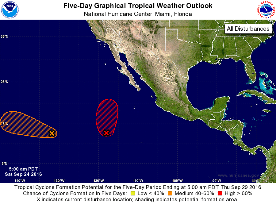
For the eastern North Pacific...east of 140 degrees west longitude:
1. A large low pressure area centered about 900 miles southwest of the
southern tip of Baja California Sur is producing disorganized shower
and thunderstorm activity. Satellite images indicate that the low's
circulation, although still broad, is gradually becoming better
defined, and environmental conditions are conducive for a tropical
depression to form during the next day or two. This disturbance is
expected to move slowly northward during the next few days.
* Formation chance through 48 hours...high...80 percent
* Formation chance through 5 days...high...90 percent
2. An area of low pressure located about 1500 miles east-southeast of
the Big Island of Hawaii is also producing disorganized showers and
thunderstorms. Environmental conditions are forecast to become more
favorable for some development of this system by early next week
while the disturbance moves generally west-northwestward.
* Formation chance through 48 hours...low...10 percent
* Formation chance through 5 days...medium...40 percent
Forecaster Cangialosi