ZCZC MIATWOEP ALL
TTAA00 KNHC DDHHMM
Tropical Weather Outlook
NWS National Hurricane Center Miami FL
500 PM PDT Wed May 27 2020
For the eastern North Pacific...east of 140 degrees west longitude:
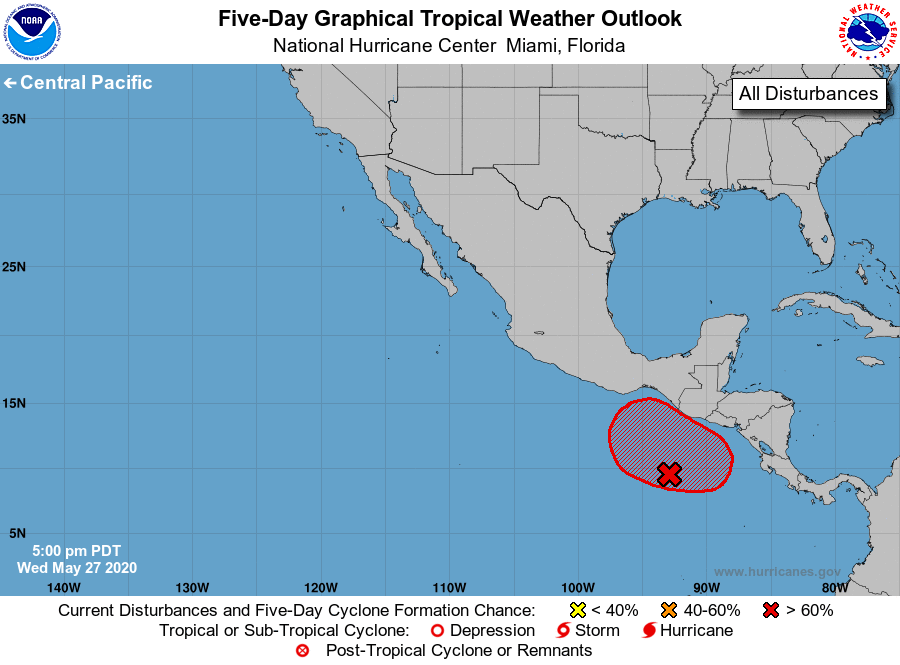
1. A large area of disorganized showers and thunderstorms located a
couple of hundred miles south of the coasts of Central America and
southern Mexico are associated with a trough of low pressure.
Environmental conditions appear conducive for gradual development
of this system, and a tropical depression is likely to form late
this week or over the weekend while it drifts northward.
Regardless of development, this system will likely produce heavy
rainfall over portions of Central America and southern Mexico
beginning late this week and continuing through the weekend.
These rains could cause life-threatening flash floods and
mudslides, especially in areas of mountainous terrain. See
products from your local weather office for additional information.
* Formation chance through 48 hours...low...30 percent.
* Formation chance through 5 days...high...80 percent.
Forecaster Cangialosi