ZCZC MIATWOEP ALL
TTAA00 KNHC DDHHMM
Special Tropical Weather Outlook
NWS National Hurricane Center Miami FL
550 AM PST Fri Jan 21 2022
For the eastern North Pacific...east of 140 degrees west longitude:
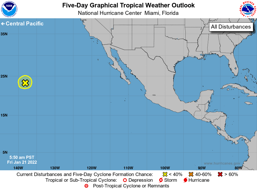
Special Tropical Weather Outlook issued to update information on
the area of low pressure located well to the east-northeast of
Hawaii.
1. Showers and thunderstorms have decreased and become less organized
in association with an area of low pressure located a little more
than 1000 miles east-northeast of Hilo, Hawaii. This system is
expected to move westward into increasingly unfavorable
environmental conditions during the next day or so, and development
into a subtropical or tropical cyclone is unlikely, although the
low is still producing strong winds on its north side. See High
Seas Forecasts issued by the National Weather Service for more
information.
* Formation chance through 48 hours...low...10 percent.
* Formation chance through 5 days...low...10 percent.
The next Special Tropical Weather Outlook on this system will be
issued by 2 PM PST today, or earlier if conditions warrant.
Forecaster Cangialosi